Archives
Enter a word or phrase to perform a general search across all records in the Archives catalog. You can also browse records in the catalog without performing a search.
Search Tips
- Searches are not case sensitive.
- Searching for multiple words connects them with OR by default. Matching records can contain any of the words.
- Connect multiple words with AND if you only want to see records containing both words.
- Use quotation marks to search for a phrase.
- Place an asterisk (*) at the end of a word as a wildcard.
240 results found. Records searched: 240
-
Permanent Collection - 2028
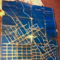
Map of Village of Glencoe, ILL Showing a System of Water Works as designed by W.S. Shields, C. E. Chicago, ILL. Constructed by Messr, Synder, & Williams. Water Works Contractor, Dayton, O.
Record Type: Archive
-
Permanent Collection - 2102
Treasure Hunters' Map from 1951 covering the area from south Highland Park on the north, Lake Michigan on the east, north Evanston on the south and then extending west to the vicinity of Wheeling. Glenview Naval Air Station is more or less in the center of the map. The villages of Glencoe, Winnetka, Glenview and Northbrook are noted, as are major roads, railroads, woods/forest preserves, and rivers in the covered area.
Record Type: Archive
-
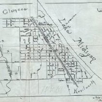
Permanent Collection - 2162
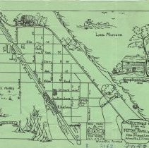
Hand-drawn map of the east part of Winnetka forms a 1949 Christmas Greetings card to Mr. Frank Windes from the Fetter family of 580 Orchard Lane, Winnetka. The map covers the area from Green Bay Road on the west, Sheridan Road on the east, Elm Street on the north and Winnetka Avenue on the South. Several building locations are noted on the map, and a number of drawings of Indian and pioneer life are included.
Record Type: Archive
-
Permanent Collection - 2179.01-.04
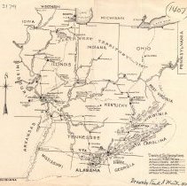
Map drawn by Frank A. Windes in 1942 of the travels of 6 generations of the Windes family from 1790 to 1941, as the family moved throughout the Midwest. The area covered includes the states of Illinois, Indiana, Ohio, Kentucky, Tennessee and parts of Mississippi, Alabama, Georgia, North Carolina, Virginia, West Virginia, Missouri and Arkansas. Each person's path is marked differently. There are four copies of the map; three are signed and date...
Record Type: Archive
-
Permanent Collection - 2242
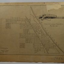
"Map of the Village of Winnetka/ Approved for the purpose of Naming Streets/ May 23d, 1983." The map mounted on cardboard appears to be a reproduction of an earlier document. In the lower left corner, text reads, "From the files and records/ of/ WINDES & MARSH/ VIllage Engineers/ January 1930."
Record Type: Archive
-
Permanent Collection - 2288.01
Map of Indian Trails & villages includes colored boundries, camps, effigi mounds, chipping stations.The boundaries are marked in red and green color. Identical to 3306.1
Record Type: Archive

-
Permanent Collection - 2288.02
Map of Indian Trails & village map; same as 2288.1 but without colored boundaries.
Record Type: Archive
-
Permanent Collection - 2288.04
Map of Chicago in 1835 includes street names, and Indian trails and sites.
Record Type: Archive
-
Permanent Collection - 2288.05
Map of Dupage County including county lines & symbols as previously used on Indian Trail & Village maps.
Record Type: Archive
-
Permanent Collection - 2288.06
Map of Indian Burial Mounds in the Chicago area. A bison is drawn on the right side. On the left, Scharf has written extensive notes.
Record Type: Archive
-
Permanent Collection - 2288.07
A map (pencil drawing) of Wilmette including an Indian site in the upper left corner. Streets are labelled.
Record Type: Archive
-
Permanent Collection - 2288.08
Hand-drawn map on tracing paper depicting Indian sites.
Record Type: Archive
-
-
Permanent Collection - 2288.12
Map of early settlers and Plow Park includes Calumet feeder coral (1848-1869) and Paddock Mill Creek. The map includes colored lines depicting Indian features.
Record Type: Archive
-
Permanent Collection - 2288.13
Map of an Indian village, mounds and portage on the south shore of Calumet Lake. The map has been marked as a duplicate.
Record Type: Archive
-
Permanent Collection - 2288.15
Map of an unidentified river and a couple streets. The only street name visible is North Ave. The streets and rivers are drawn in pen over notations drawn in very faded pencil.
Record Type: Archive
-
Permanent Collection - 2288.17
Map of "Section 13." In the upper-right corner, a Trail to Antioch is labelled. The hand-drawn map includes elevations above the lake.
Record Type: Archive
-
Permanent Collection - 2288.19
Pencil map with note in bottom right corner: Note, 1870, Excavation made at "random" among the other mounds.
Record Type: Archive
-
Permanent Collection - 2288.20
Hand-drawn pencil map with some pen lines. The map depicts a section of the Des Plaines River, and marks specific spots along the shore.
Record Type: Archive
-
Permanent Collection - 2288.21
Pencil map of a section of Chicago, including State St. and Halstead. Trails are marked over the street map.
Record Type: Archive
-
Permanent Collection - 2288.22
Hand-drawn pencil map of area including Michigan Ave. and the Illinois Central tracks. Superimposed on the streetmap are Indian trails and sites, along with the location of a log house.
Record Type: Archive
-
Permanent Collection - 2288.23
Map including sketch of Indian mounds and dates.
Record Type: Archive
-
Permanent Collection - 2288.24
Pen-drawn map of area of North Ave and Sheridan Rd. In green, the Green Bay trail and the Patterson Tavern and Garland Tavern are marked, along with their years of operation.
Record Type: Archive
-
Permanent Collection - 2288.25
Draft of title and legend for the map "Indian Trails and Villages of Chicago and of Cook, Dupage and Will County's, Ills."
Record Type: Archive
-
Permanent Collection - 2288.26
Small hand drawn pencil map of section 35 of Antioch, featuring an Indian fort near the Fox River.
Record Type: Archive
-
Permanent Collection - 2609
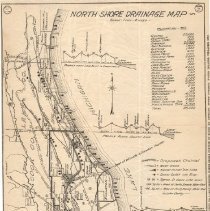
Map shows the North Shore portion of the Metropolitan Sanitary District, including the portion of Lake and Cook Counties east of the DesPlaines River from the far north side of Chicago to Waukegan. The map marks water intake and sewer outlets along the lake, along with sewer outlets into rivers and the location of the various villages. It gives elevation profiles from Lake Bluff to Libertyville, along the County Line and along Chicago North Limi...
Record Type: Archive
-
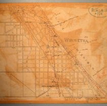
Permanent Collection - 2773
A large map, mounted on cloth, of north Winnetka/south Glencoe covering the area from Pine Street on the south, Lake Michigan on the east, Jackson/Woodlawn on the north and Grove Street on the west. It is a composite of 35, approximately 6 x 6.5" rectangles that are fitted together to make the whole, and appears to be part of a larger map covering all of Winnetka. The map shows subdivisions, streets, lots and lot sizes.
Record Type: Archive
-
Permanent Collection - 2776
Map of Winnetka showing the location of various Indian trails, canoe trails, springs, boulders, timber lines, graves. The map also idenifies the location of the sites of the houses of several early Winnetka settlers. The notes and map were made by Albert Scharff of Winnetka and the date 1912 is written by the title, although one marking was made at a later date, being dated 1917.
Record Type: Archive
-
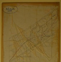
Permanent Collection - 2778
Map of Hubbard Woods mounted on board. The map shows the Hubbard Estate Subdivision and the Gilbert Hubbard Subdivision divided into lots, covering the area from Tower Road on the south, Lake Michigan on the east, the Railway on the west and an undentied street (probably Woodlawn) on the north. The map also covers the area north of the subdivsions extending into Glencoe. Sheridan Road and Green Bay Road (now Old Green Bay Road) are identified; ...
Record Type: Archive
-
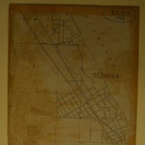
Permanent Collection - 2779
Map of Glencoe mounted on board. This is an extension of the Map of Hubbard Woods (Identification #2778). The map showns the street grid with unnamed streets of early Glencoe extending from north Hubbard Words to County Line Road, with an extenstion into southern Highland Park. The only structures noted on the map are the Hubbard Woods Depot, the Glencoe Depot and 21 Mile House at the Corner of Green Bay Road and County Line Road. The red br...
Record Type: Archive
-
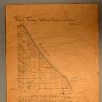
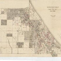
Permanent Collection - 2782
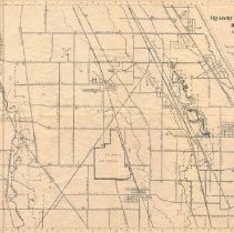
A 1921 copy certified by the Department of Interior on May 23, 1921 of the plat of the Fractional Township 42 North, Range 13 east of the 3rd Principal Meridian located on the western side of Lake Michigan. It reflects a number of marshes in the area and the location of the Village of Winnetka has been outlined in red. The plat includes a certification of William Milburn, surveyor of the public land of the States of Illnois and Missouri, dated ...
Record Type: Archive
-
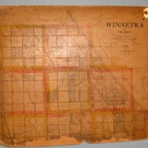
Permanent Collection - 2785
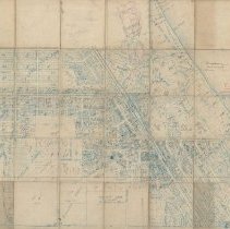
Map of Winnetka and vicinity (on board). The map covers the area bounded by Jackson/Woodlawn Avenues (Glencoe) on the north, Lake Michigan on the east, the southern limit of the Village of Kenilworth on the south, and the New Trier Township border on the west. Streets, subdivisions, lots and dimensions are shown. The map is divided into alternating red and yellow squares which are each further subdivided into 16 smaller squares.
Record Type: Archive
-
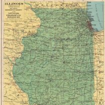
Permanent Collection - 2873
Map of Illinois as compiled and drawn in the Cartographic Section of the National Geographic Society for the National Geographic Magazine. An inset of the Chicago area is located at the bottom left corner of the map.
Record Type: Archive
-
Permanent Collection - 2903
Photocopy of an 1896 Map of Winnetka drawn on in red pencil by Samuel Shackford Otis. The map shows the location of old residences that existed in the 1890s. Red "X"es are drawn over those that had been known to be demolished as of the 1930s. Includes a comprehensive list of names of owners of the homes / buildings (carbon copy and paper copy) and first person accounts of people and homes from Susan Garland, Kate Dwyer, and Mary Mcfarlin (yellow ...
Record Type: Archive
-
Permanent Collection - 2906
Map of Winnetka drawn by Peter Gerhard, including street names, rivers, and railroads. The site of Patterson Tavern is identified. The surrounding communities are identified.
Record Type: Archive
-
Permanent Collection - 2907
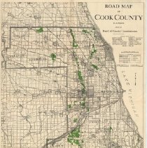
Road map of Cook County, IL, including roads, towns, townships, forest preserves (shown in green) and railroads. Issued by the Board of County Commisioners, all of whom are identified under the title.
Record Type: Archive
-
Permanent Collection - 3082.1
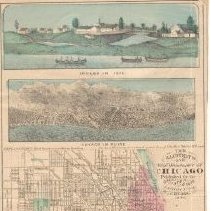
Small, fold-out map of Chicago "published for the Great Inter-State Exhibition of Chicago. 1873." The area covered by the map extends from Wrightwood on the north, Lake Michigan on the east, 42nd Street on the south, and Harding Avenue on the west. The map includes four colored illustrations: "Chicago in 1820," "Chicago in Ruins" (of the Great Chicago Fire), "Chicago 1873," and of the "Inter-State Industrial Exhibition of Chicago" itself. The s...
Record Type: Archive
-
Permanent Collection - 3082.2
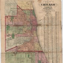
An 1873 Map of Chicago showing steets, city wards and neighborhoods from roughly Diversey on the north through Hyde Park on the south, Lake Michigan on the east and out to Central Park on the west. The boulevard system and parks are shown in green. The various sections of the city are colored in pink, yellow, white, purple or light green. The central section of the city is outlined with a heavy red border and a smaller section of the central a...
Record Type: Archive
-
Permanent Collection - 3114
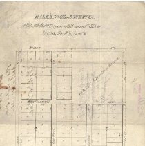
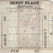
A plat survey of one of Dale's Winnetka subdivisions known as "Depot Place." The subdivision is comprised of Block 13; the block bordered by Grant, Birch, Chestnut, and Elm Streets. The block has been subdivided into 16 lots. The deminisons of each are given. The document has been signed by the surveyor, Winnetka Council president, a Cook County official and a notary, along with owner John Dale. On the reverse side is the signature of the Rec...
Record Type: Archive
-
Permanent Collection - 3115
Plat of survey of one of Dale's Winnetka subdivisions. This one is described as the 3rd Addition and as being the northeast 1/4 (except the northeast 1/4 thereof) of the southeast 1/4 of Section 20. The included map depicts an area bounded by 4th St, Hazel St, Birch St, and Willow St. It shows the lots and the lot sizes. As noted, the map is blank in the northeast corner, which was not part of the plat, given that Dale had owned it since 1872 (...
Record Type: Archive